Traditionally, they heavily relied on Google Street View for virtual site visits but faced challenges with outdated imagery. That’s where Curtis DeVault, MA, GISP, GIS Administrator at Pickett and Associates, stepped in, driving innovation and operational efficiency.
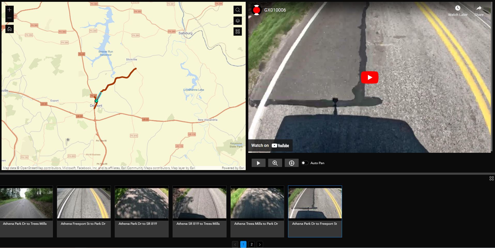
“With Site Viewer 360 for ArcGIS, we seamlessly integrate 360° imagery into our custom Esri Web Applications,” says Curtis DeVault. This ArcGIS widget has transformed their workflow, providing unparalleled access to high-quality imagery right within their existing web tools.
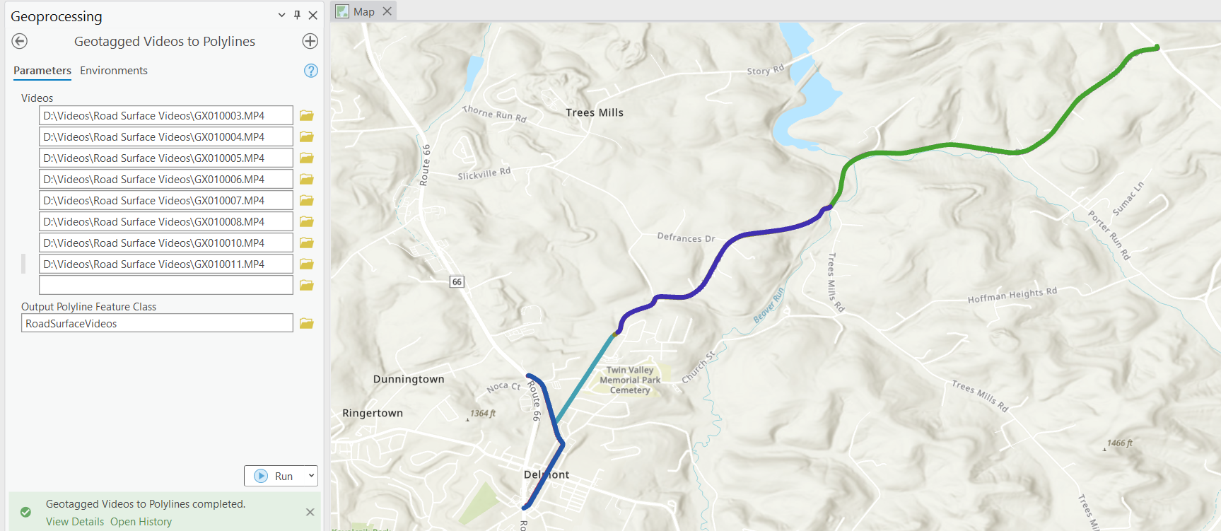
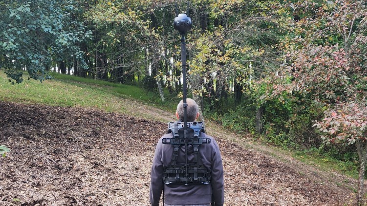
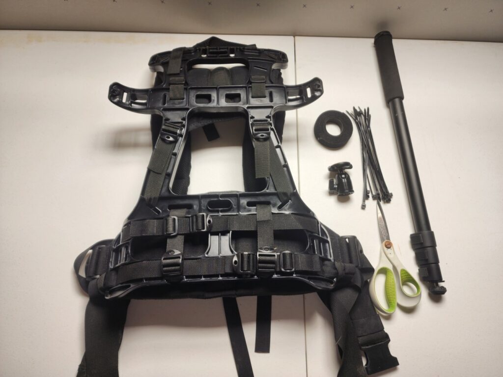
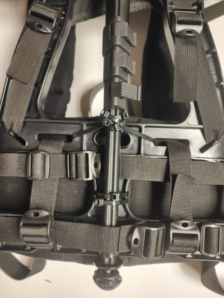
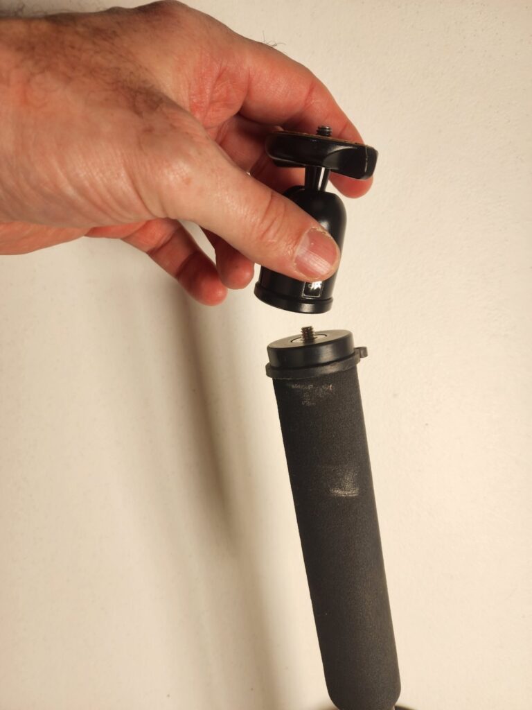
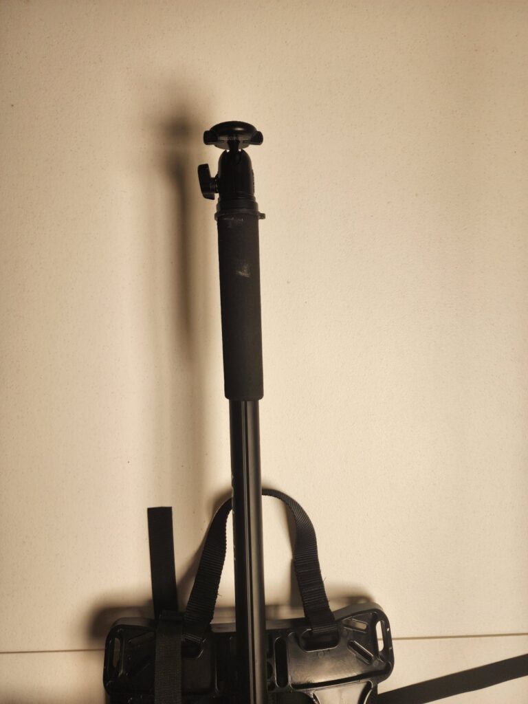
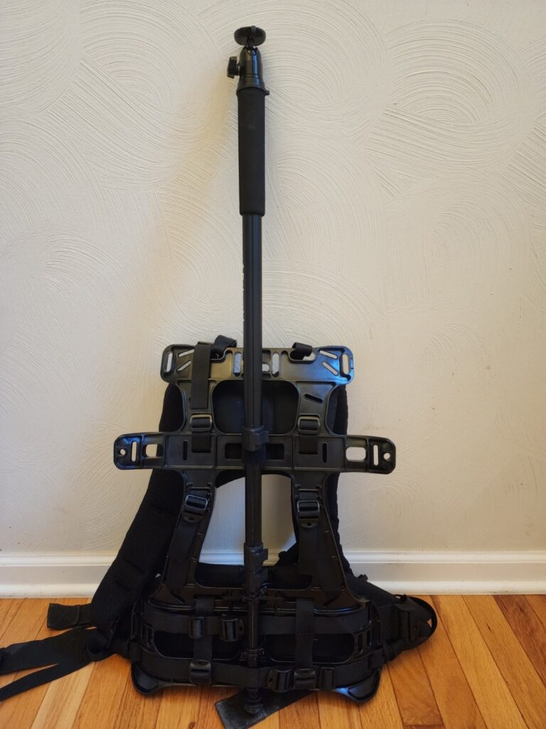
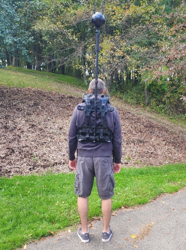
Pickett and Associates have deployed numerous GoPro MAX 360-degree cameras to capture fresh Street View 360° imagery. This allows field personnel to easily capture 360° photos. Engineers can then access immersive 360° imagery of project sites within hours of collection in ArcGIS, significantly boosting project efficiency and decision-making processes.
Site Viewer 360 for ArcGIS seamlessly integrates large volumes of 360° photos into both ArcGIS Online and Enterprise. The imagery can be securely stored in AWS, Azure, or IIS, and accessed with ease through ArcGIS.
Author Archive: Clark Selby
Service-Disabled Veteran-Owned Small Business
We’re thrilled to announce that Nodeology has been officially certified as a 𝗦𝗲𝗿𝘃𝗶𝗰𝗲-𝗗𝗶𝘀𝗮𝗯𝗹𝗲𝗱 𝗩𝗲𝘁𝗲𝗿𝗮𝗻-𝗢𝘄𝗻𝗲𝗱 𝗦𝗺𝗮𝗹𝗹 𝗕𝘂𝘀𝗶𝗻𝗲𝘀𝘀 (SDVOSB)!
Nodeology’s 360° Photo & Video ArcGIS Experience Builder widgets are already empowering Civil & Environmental firms and Emergency Management teams globally. With SDVOSB status, we’re excited to expand our geospatial impact to the federal market.
We bring extensive geospatial expertise in:
• Implementing 360° and video workflows for infrastructure & asset management
• Driving operational efficiencies
• Creating seamless geospatial solutions with a holistic view of infrastructure conditions
Let’s connect!
Are you processing video or photos in your ArcGIS workflows?
We’re thrilled to announce the release of our new Geotagged Media Processing toolset for ArcGIS. This toolset is designed to make video and photo processing easy, improve workflow efficiency, and add new and exciting capabilities to your GIS solutions.
Tools:
- Geotagged Videos to Polylines
- Geotagged Video to Photos
- Append Geotagged Videos
- Append Geotagged Photos to Points
All of these tools are designed to be natively compatible with our Site Viewer 360 for ArcGIS and GeoTube for ArcGIS Widgets, in addition to a wide variety of georeferenced photo and video workflows.
Details:
Geotagged Videos to Polylines
The Geotagged Videos to Polylines tool creates polyline features from geotagged video files. By using the GPS information recorded in the videos, it creates accurate polyline representations suitable for various GIS applications. The tool is designed to be fully compatible with Nodeology’s geo-immersive video widgets, while also providing utility for a wide range of other geospatial tasks.
Geotagged Video to Photos
The Geotagged Video to Photos tool is an innovative solution for converting geotagged videos into georeferenced photos at user-defined intervals.
This tool is versatile, supporting both standard and 360° panoramic videos, and preserves the format of the source video in the extracted images. Whether your source is a conventional 2D video or a panoramic 360° video, the output will match, ensuring seamless integration into your existing geospatial workflow.
Append Geotagged Videos
The Append Geotagged Videos tool extends the functionality provided by the Geotagged Video to Polylines tool by appending an existing feature class. This makes updating existing feature classes quick and easy and provides a simple way to add new videos to your existing ArcGIS applications.
Append Geotagged Photos to Points
The Append Geotagged Photos to Points is a convenience tool that extends ESRI’s Geotagged Photos to Points geoprocessing tool. This provides a quick and easy way to append photos to an existing feature class and add new photos to your existing ArcGIS applications.
We’ve got many more useful geotagged photo and video processing tools planned and in development. Want to know more about the toolset? Curious about what we have coming? Have an idea for a tool that you would like to see included? Let us know!
About Nodeology
About Nodeology: Nodeology, the visionary developer behind these cutting-edge tools, specializes in delivering advanced geospatial 360° imagery solutions that are designed to elevate operational efficiencies. With a strong commitment to developing user-friendly tools, Nodeology actively promotes the adoption of operational efficiencies across various sectors, recognizing the pivotal role of ArcGIS solutions for local governments, emergency management, and AEC firms.
Nodeology’s dedication to user-friendly innovation is further exemplified through their exceptional tools:
- Site Viewer 360 for ArcGIS: Seamlessly integrating 360° photos into ArcGIS workflows, this tool enhances visualization and collaboration, offering a comprehensive solution for immersive geospatial experiences.
- GeoTube for ArcGIS: Streamlining the integration of 2D and 360° video into ArcGIS, GeoTube caters to professionals with varying levels of GIS experience.
For more in-depth information about Nodeology’s transformative 360° tools, please email us at info@nodeology.net.
Supercharge your GIS Application Delivery with GaiaBuilder
Developing solutions in ArcGIS often feels like a precarious game of Jenga. A minor alteration in the geodatabase, such as adding a field or modifying domains, can trigger an avalanche of issues. The stakes are higher when adjustments are made in a live environment, a common scenario when dealing with client-facing applications.
Picture being on the verge of a crucial geospatial project deadline. After investing hours meticulously crafting the software solution, the fear of deployment-induced errors sets in. When these errors inevitably surface, frustration mounts, delays incur costs, and the project’s success hangs in the balance.
Alleviating the Pain of Geospatial Solutions Delivery
Geospatial solution development has long been fraught with complexities, time constraints, and a persistent fear of errors. However, there is a solution. Imagine a seamless software development process, where your hard work transitions smoothly through every stage. Envision effortless deployments, confident that your solution meets the needs of your projects. This ensures timely delivery and elevates the quality and efficiency of your GIS solution development.
The GaiaBuilder Advantage
We are pleased to introduce GaiaBuilder – your compass towards a pain-free GIS solution development journey.
- Version Tracking: Easily track and manage changes to your ArcGIS projects over time. Every change is saved, enabling swift reversions in case of mistakes or unexpected issues.
- Effortless Propagation of Changes: Traditionally, maintaining multiple environments in ArcGIS has been difficult. Now, you can swiftly propagate changes from development to testing to production.
- Seamless Collaboration: Multiple team members can work on a project simultaneously without overriding each other’s work, leading to faster and more efficient project completion.
- Continuous Delivery Integration: Seamlessly integrate your ArcGIS solutions with other systems for faster and more reliable delivery.
- Transparent Modifications: View a detailed history of all modifications, fostering accountability and clarity within the team.
- Confidence & Peace of Mind: Knowing that every change is documented and stored safely means less worry and more focus on creating outstanding GIS solutions.
- Emergency backup: Gaiabuilder can even be used as a backup/recovery solution, in case of any ArcGIS environment emergency.
GaiaBuilder in North America
Merkator, a leading Dutch/Belgian geospatial software provider, is excited to announce its strategic reseller agreement with Nodeology, LLC. This partnership designates Nodeology as an authorized reseller of GaiaBuilder software in North America, significantly expanding Merkator’s presence in the region.
Nodeology, based in Pittsburgh, Pennsylvania, is a geospatial software development firm specializing in creating user-friendly ArcGIS tools for 360-degree video and imagery, tailored to streamline road and other infrastructure inspections.
For more information on GaiaBuilder, please visit:
- North America: www.nodeology.net | GaiaBuilder
- Europe & Worldwide: www.merkator.com | GaiaBuilder
Are you ready to revolutionize your GIS application delivery? Share your thoughts below and let’s embark on this journey together!
Assembling a Backpack Camera Rig for 360º Image Collection
If you are collecting 360º imagery, you may have noticed a distinct lack of viable camera mounting options when on foot. Over the years I have seen a variety of options, including helmet mounts, handheld monopods, third-person harnesses, and backpack mounts. Many of the currently available options have their flaws. Helmet mounts require constant awareness of your head position and may interfere with the integrity of safety devices. Handheld monopods are a great solution for small, rapid collection scenarios, but will get tiresome in a hurry. Third-person harnesses are designed to capture you during your activity and lack the features typically required for capturing quality imagery of a site. Most currently available backpacks mounts are either flimsy (little more than a basic backpack with a monopod attachment), expensive, or both. Oddly enough, it seems that there used to be some good backpack options available, but many of them are no longer available, likely due to lack of sales.
So, where does that leave us? In all likelihood, that means assembling our own rig. Before we get started, let’s consider what we need in a good 360º camera rig:
- Stability: Whether you’re collecting still images or videos, it’s critical to ensure that your captures are stable and consistent. An unstable rig can cause additional post-processing at best and ruin a project at worst.
- Comfort: Field data collection is enough of a challenge. We don’t need our gear to make things worse.
- Portability: Not everyone will be driving to a job site in a large work truck or van. A rig needs to be portable enough to throw in the trunk or backseat of a compact car, even if it’s already crammed with stuff.
- Adjustability: Sometimes your camera needs to be low and compact to clear tree branches and other obstructions while walking on a rugged terrain. Other times you may want to have your camera extended to capture a wider view of the surroundings or assets at height. One rig that can support a wide range of situations is ideal.
- Clean, Professional Appearance: Just because you can fix up a rig with duct tape and some pallet wood, doesn’t mean you should. Any time you’re out in the field, you’re representing your company, so you want to make sure you look professional, even if you’re trudging through the mud. Even if there’s nobody around to see you, we are collecting 360º imagery here. Unless you plan on post-processing to remove the data collector from all of your photos, your customer is going to see your rig.
The Rig: What You'll Need
Backpack Frame and Straps Set
For our purposes, we need something lightweight, stable, and comfortable that will serve as a sturdy mount for our monopole. Ideally, we want something that will permit mounting the monopole in the center of the pack for maximum comfort and picture quality.
For my rig, I’m using the Mountaineering-Style Pad Set from Down East Innovation. It’s based on the 1606AC frame commonly used by the military. At just $125, it’s well worth the price.
Monopod
We need something sturdier than a selfie-stick, but there’s no need to break the bank here. There are a variety of options in the $20 range, including Amazon Basics and Altura. There are options as long as 72″, but that’s likely to be far taller than we can wear safely. Don’t worry too much about features, since it’s likely going to remain attached to your backpack. Find something with good reviews that will attach to a backpack with ease and go for it.
Adjustable Ball Head
Unless you walk and run like Forest Gump or the T1000 from T2, you’re going to want a ball mount to keep your camera as straight and level as possible during data collection. A ball mount will provide maximum flexibility to align and rotate your camera. This is another case where simple, sturdy, and reliable is ideal. There are options from UTEBIT, SIOTI, and others that will be more than sufficient for our needs.
Zip Ties
Sure, there are other ways that we can attach the pole, but zip ties just work. They are strong, sturdy, and do a great job of holding the monopod and camera in place. If done right, they will also leave a very professional appearance, especially when color-matched to the backpack. Heavy-duty 8″ black zip ties are ideal for our purposes.
Velcro Straps (Optional)
If you want to be able to collapse the monopod as much as possible for transportation and storage, you may opt for a Velcro strap for the upper mounting position. This will enable you to loosen the strap to further collapse the monopod. Velcro One-Wrap Roll.
Scissors
For cutting zip ties and Velcro straps.
Assembly: Prepare the backpack.
Your pack is likely to arrive with the buckles centered on the back of the frame. Since we plan to mount our monopod there, this isn’t ideal. Adjust your straps so that the buckles are just off-center, providing the ideal space necessary for the monopod.
Fasten the monopod to the frame.
Align the pack on the center of the frame.
(Optional) Insert pole between the lower strap and frame for a more secure connection.
Securely fasten the lower part of the monopod to lower-most portion of the frame.
Securely fasten the middle connections using zip ties. Some additional zip ties used as cross-members are helpful for a stable connection. For a cleaner look, you may prefer to place the zip ties such that the “buckle” of the zip tie is hidden on the back side of the frame. The tie buckles are pictured here on the front side for clarity.
If you’re using a Velcro strap for the upper connection, you will need a strap approximately 10-12″ in length. Wrap your strap tightly around the pole at least one full time, weave it through the frame then secure it tightly onto itself. If you prefer a stronger connection at the expense of adjustability, feel free to substitute zip ties for the Velcro strap.
Attach the ball mount.
Our fully assembled pack.
Our rig with shown with an Insta360 Pro II
Conclusion
With that, you should have a ready-to-go rig for field data collection.
Looking to make optimal use of your 360º imagery for display in your ArcGIS environment? Site Viewer 360 for ArcGIS and GeoTube for ArcGIS are an easy way to visualize your 360º data within ArcGIS Web AppBuilder and Experience Builder.
GeoTube: Geospatially Accurate 360° and 2D YouTube Videos in ArcGIS
Roadway and Other Infrastructure Inspections Made Effortless
YouTube’s integration with ArcGIS has resulted in a seamless and highly effective solution for road and other infrastructure inspections. Enter “GeoTube for ArcGIS,” a tool that facilitates efficient and cost-effective data collection. By effortlessly incorporating 2D and 360-degree videos into your workflows, GeoTube offers an intuitive understanding of spatial relationships, revolutionizing the inspection experience.
360 and 2D YouTube Videos Geospatially Displayed in ArcGIS:
GeoTube for ArcGIS takes full advantage of geospatial capabilities, presenting video paths and playback locations within web maps. Two-way integration means that you can see the video path and playback location displayed on your map during video playback. The current playback time/location can be controlled via the integrated YouTube player or via clicking any point along the video path in your map. This seamless integration makes it possible to visualize your sites and assets like never before possible.
Simple Video Capture Process:
GeoTube makes video capture a straightforward task for professionals. With the convenience of GPS-enabled cameras, such as smartphones or affordable 360 cameras like the GoPro, project sites can be captured effortlessly. No need to cordon off roads or other projects, as a single driver or field person can drive or walk the site and capture videos from every angle. This reduces liabilities associated with multiple individuals onsite and enhances safety during inspections.
Empowering Non-GIS Personnel:
GeoTube for ArcGIS breaks down barriers for non-GIS personnel, including field staff, surveyors, and civil engineers. With little to no GIS experience, these individuals can now effectively utilize ArcGIS with GeoTube for various applications, boosting collaboration and efficiency.
Use Cases:
- Roadway Management: GeoTube enables quick reporting on roadway conditions, defects, and other transportation infrastructure issues. Whether using ESRI’s Roadway Management solution or a fully customized approach, GeoTube significantly enhances road maintenance efficiency.
- Large Scale 360 Virtual Tours: Immerse clients in geospatially accurate virtual tours of various project sites, from large construction projects to landslides to disaster recovery efforts. Replace traditional presentations with interactive geospatial experiences, enabling seamless communication and greatly improved understanding of project and site conditions.
- Client Collaboration: Project Managers without GIS experience can leverage GeoTube to visualize drainage options, road slopes, nearby landmarks, traffic conditions, and accessibility. This aids in providing accurate quotes and fostering effective client communication.
- AEC Team Efficiency: GeoTube empowers construction teams to visualize construction timelines, conduct site inspections, and manage logistics directly within ArcGIS. 360-degree videos captured by field personnel can be viewed by AEC teams and clients, providing a virtual on-site experience.
Experience Builder for Streamlined Workflows:
Maximize the potential of GeoTube with user-friendly workflows, facilitated by its integration with ArcGIS Experience Builder. Highly configurable solutions enhance efficiency and reduce project costs, backed by Nodeology’s expertise in creating ArcGIS tools for 360 videos and imagery.
Conclusion:
GeoTube for ArcGIS represents a paradigm shift in roadway and other infrastructure inspections. By seamlessly integrating YouTube 2D and 360 videos with GIS data, the tool simplifies data collection, streamlines collaboration, and boosts overall efficiency across disciplines. Explore the potential of GeoTube by visiting us at: https://www.nodeology.net/geotube/.
360° Imagery in ArcGIS: Unlocking the Potential of Effective Asset Management and Infrastructure Inspection
In today’s competitive landscape, the right tool can make all the difference in asset management, infrastructure inspection, and client communication. Enter Site Viewer 360 for ArcGIS, a game-changer that enables seamless integration of 360° imagery within ArcGIS Online and Enterprise. With its immersive visuals, Site Viewer 360 empowers organizations to unlock the full potential of their assets, streamline workflows, and make informed decisions.
To experience the ease of working with 360° imagery in ArcGIS, Nodeology has released three interactive demos available at https://www.nodeology.net/site-viewer-360-for-arcgis/. These demos allow users to immerse themselves in the power of using 360° imagery for engineering projects, gaining firsthand insights into its capabilities with the feeling of being on the ground.
Advantages of Using Site Viewer 360 for Engineering Projects:
- Streamlined Workflows: Save time and enhance efficiency by quickly navigating to specific locations of interest. With Site Viewer 360, engineers and GIS personnel can focus on critical areas without the need to scroll through irrelevant images.
- Immersive Visualization: Gain a comprehensive understanding of jobsites with a 360-degree view. By visualizing assets from all perspectives within ArcGIS, teams can identify crucial details and potential issues more efficiently.
- Progress Monitoring and Remote Inspections: Stay on top of project progress and conduct inspections remotely with real-time insights from updated GIS mapping data. Site Viewer 360 eliminates the need for physical presence on-site, enabling data-driven decision-making.
- Competitive Advantage: Capture imagery cost-effectively using budget-friendly 360° cameras or collaborating with Reality Capture specialists. Accurate and confident project documentation leads to well-supported bids and increased success rates.
- Efficient Collaboration: Foster effective collaboration by sharing realistic on-location experiences with stakeholders. Site Viewer 360 eliminates the need for lengthy descriptions, enabling better understanding and faster decision-making.
- Fully Integrated Solution: Seamlessly integrate Site Viewer 360 within the familiar ArcGIS interface. Display mapped assets alongside 360° imagery for a comprehensive view that enhances accuracy and understanding.
In conclusion, Site Viewer 360 is a powerful tool that empowers organizations to achieve efficient asset management and infrastructure inspection. By leveraging immersive 360° imagery within ArcGIS, teams can enhance workflows, make informed decisions, and stay ahead of the competition. Embrace the power of Site Viewer 360 and unlock new possibilities for your organization’s success.
Discover how Nodeology can optimize your operations with our user-friendly ArcGIS solutions for 360° video and imagery. Visit our website at www.nodeology.net or reach out to us via email at info@nodeology.net. We are committed to supporting your organization’s success.
About Nodeology:
Nodeology specializes in developing user-friendly ArcGIS tools for 360° video and imagery, with a particular focus on streamlining road and infrastructure inspections. Our solutions are tailored to enhance workflow efficiencies, reduce project costs, and mitigate on-site liabilities. With Nodeology, you can achieve optimal results in your operations, benefiting from improved efficiency and enhanced data visualization capabilities.
Nodeology Receives Veteran-Owned Small Business Certification
Nodeology, LLC is proud to announce its official certification as a Veteran-Owned Small Business (VOSB) by the U.S. Department of Veterans Affairs (VA). This recognition is a significant achievement for us, and we are excited to contribute our services in support of our country’s essential operations.
Owner and Founder Anthony Grescavage brings extensive military experience to Nodeology, serving as a Topographic Analyst (GIS Engineer) in the Army. With the rank of sergeant (E5) and a deployment to Iraq, Anthony played a pivotal role in implementing the first theater-wide geospatial database in the country. He also contributed as a geospatial technology instructor, training military transition teams and facilitating integration with Iraqi units.
This certification opens up exciting opportunities for collaboration with the VA and other federal agencies. Nodeology remains dedicated to delivering high-quality ArcGIS tools and services that empower organizations to harness the full potential of location data across their entire operations. Our specialized 360 imagery tools for ArcGIS are designed to streamline road and infrastructure inspections, enhancing workflow efficiencies, reducing costs, and mitigating on-site liabilities.
Discover how Nodeology can optimize your operations with our user-friendly ArcGIS solutions for 360 video and imagery. Visit our website at www.nodeology.net or reach out to us via email at info@nodeology.net. We are committed to supporting your organization’s success.
About Nodeology
Nodeology specializes in developing user-friendly ArcGIS tools for 360 video and imagery, with a particular focus on streamlining road and infrastructure inspections. Our solutions are tailored to enhance workflow efficiencies, reduce project costs, and mitigate on-site liabilities. With Nodeology, you can achieve optimal results in your operations, benefiting from improved efficiency and enhanced data visualization capabilities.
360° Imagery Integration in ArcGIS: Revolutionizing Civil Engineering Workflows
In recent years, the integration of 360-degree imagery into various industries has been nothing short of revolutionary. With the advent of 360 software tools for ArcGIS, the civil engineering sector is now poised to harness the power of immersive visuals. This technology promises to transform project workflows, reduce costs, expedite delivery times, and confer a competitive edge.
360 Cameras: Beyond Construction Sites:
While 360 cameras have become a staple in the building construction industry, their potential extends far beyond. With intuitive software tools, professionals can now leverage 360-degree imagery for diverse civil engineering projects, regardless of scale. The process is straightforward: a field technician captures every angle of a site using a 360 camera, such as a GoPro, and shares this imagery in ArcGIS, thereby supporting the entire AEC team.
Empowering the Non-GIS Professional:A game-changing aspect of this innovation is its accessibility to individuals with little to no GIS experience. Through this technology, professionals can navigate ArcGIS while virtually immersing themselves in the project site. This capability brings numerous advantages:
- Streamlined Workflows: 360 imagery seamlessly integrated into ArcGIS allows for focused navigation, saving valuable time and boosting overall efficiency.
- Enhanced Visualization: A 360-degree view of assets within ArcGIS provides contextualized data, improving analysis and decision-making.
- Remote Inspections and Progress Monitoring: Real-time insights from GIS mapping data, made possible by 360 imagery, facilitate remote inspections and data-driven decision-making.
- Competitive Advantage: Informed by comprehensive spatial data, professionals can bid more accurately, enhancing the likelihood of project success.
- Efficient Collaboration: Sharing immersive on-site experiences fosters understanding, thereby accelerating decision-making processes.
Use Cases: Transforming Engineering Workflows
The applications of 360 imagery in ArcGIS are wide-ranging and transformative:
- Large-Scale 360 Virtual Tours: Geospatially accurate virtual tours offer interactive experiences for clients, enabling effective communication and improved project understanding.
- AEC Team Efficiency: Construction teams benefit from on-site visualizations, aiding in construction management and logistics.
- Roadway Management: Quick and accurate reporting of roadway conditions becomes possible through 360 imagery and video.
- Sign Management: Streamlined sign inspections and accurate assessments are enabled by integrating 360 video and imagery with ArcGIS.
- Client Collaboration: Project managers leverage 360 imagery to visualize project aspects, enhancing client interactions and quote accuracy.
Tools and Expertise:
Two user-friendly tools to explore are Site Viewer 360 for ArcGIS and GeoTube for ArcGIS (https://www.nodeology.net/site-viewer-360-for-arcgis/ and https://www.nodeology.net/geotube/). These tools effortlessly integrate 360 imagery and video into ArcGIS workflows.
Moreover, Nodeology offers expertise in developing custom workflows that cater to teams, regardless of their GIS experience. Our proficiency in workflow design has helped engineering firms become industry leaders, enhancing efficiency, project outcomes, and overall success.
Conclusion:
The integration of 360 imagery into ArcGIS is revolutionizing the civil engineering landscape. By empowering professionals with immersive spatial insights, it streamlines workflows, enhances visualization, and fosters efficient collaboration. With tools like Site Viewer 360 and GeoTube, civil engineers can leverage the power of 360-degree imagery to improve project delivery, reduce costs, and gain a competitive advantage in an evolving industry.
Join Us at EnerGIS 2023 – 𝐀 𝟑𝟔𝟎° 𝐕𝐢𝐬𝐮𝐚𝐥 𝐉𝐨𝐮𝐫𝐧𝐞𝐲 𝐨𝐟 𝐑𝐨𝐚𝐝𝐬 𝐚𝐧𝐝 𝐎𝐭𝐡𝐞𝐫 𝐈𝐧𝐟𝐫𝐚𝐬𝐭𝐫𝐮𝐜𝐭𝐮𝐫𝐞 𝐰𝐢𝐭𝐡𝐢𝐧 𝐀𝐫𝐜𝐆𝐈𝐒
Join Anthony Grescavage from Nodeology on a 360° visual journey within ArcGIS, where road and infrastructure inspections attain unmatched workflow efficiencies.
𝐑𝐨𝐚𝐝𝐰𝐚𝐲 𝐌𝐚𝐧𝐚𝐠𝐞𝐦𝐞𝐧𝐭:
For professionals in the Oil & Gas industry, road damage can lead to significant DOT liabilities. Discover how real-time monitoring empowers you to visualize before-and-after conditions, collaborate seamlessly with transportation agencies, and mitigate potential liabilities.
𝐆𝐞𝐨𝐬𝐩𝐚𝐭𝐢𝐚𝐥 𝐕𝐢𝐝𝐞𝐨 𝐢𝐧 𝐀𝐫𝐜𝐆𝐈𝐒:
Experience the power of video integration in ArcGIS, where you can swiftly report on road conditions, defects, and transportation infrastructure. Whether you’re utilizing ESRI’s Roadway Management solution or a customized approach, geospatially accurate video turbocharges your roadway management efficiency.
𝐂𝐨𝐧𝐬𝐮𝐦𝐞𝐫-𝐆𝐫𝐚𝐝𝐞 𝟑𝟔𝟎° 𝐂𝐚𝐦𝐞𝐫𝐚𝐬:
Witness live demos with affordable 360° cameras. These compact cameras provide panoramic, detailed insights without the complexities, high costs, or logistical challenges associated with UAVs or lidar systems.
𝐄𝐦𝐩𝐨𝐰𝐞𝐫𝐢𝐧𝐠 𝐍𝐨𝐧-𝐆𝐈𝐒 𝐏𝐫𝐨𝐟𝐞𝐬𝐬𝐢𝐨𝐧𝐚𝐥𝐬:
What truly sets this innovation apart is its ability to empower individuals, regardless of their GIS experience. We’ve designed workflows that are straightforward and visualization-centric, ensuring that all departments can unlock their full potential. This democratization of geospatial softwares enhances project delivery, cuts costs, and elevates service to our communities.
𝟑𝟔𝟎° 𝐕𝐢𝐝𝐞𝐨 𝐒𝐨𝐟𝐭𝐰𝐚𝐫𝐞 𝐟𝐨𝐫 𝐀𝐫𝐜𝐆𝐈𝐒:
Dive deep with GeoTube for ArcGIS. This user-friendly software simplifies 360° video integration in ArcGIS and caters to professionals at all GIS experience levels.
Join us at EnerGIS 2023 and be at the forefront of the geospatial revolution! We can’t wait to see you there.