Roadway and Other Infrastructure Inspections Made Effortless
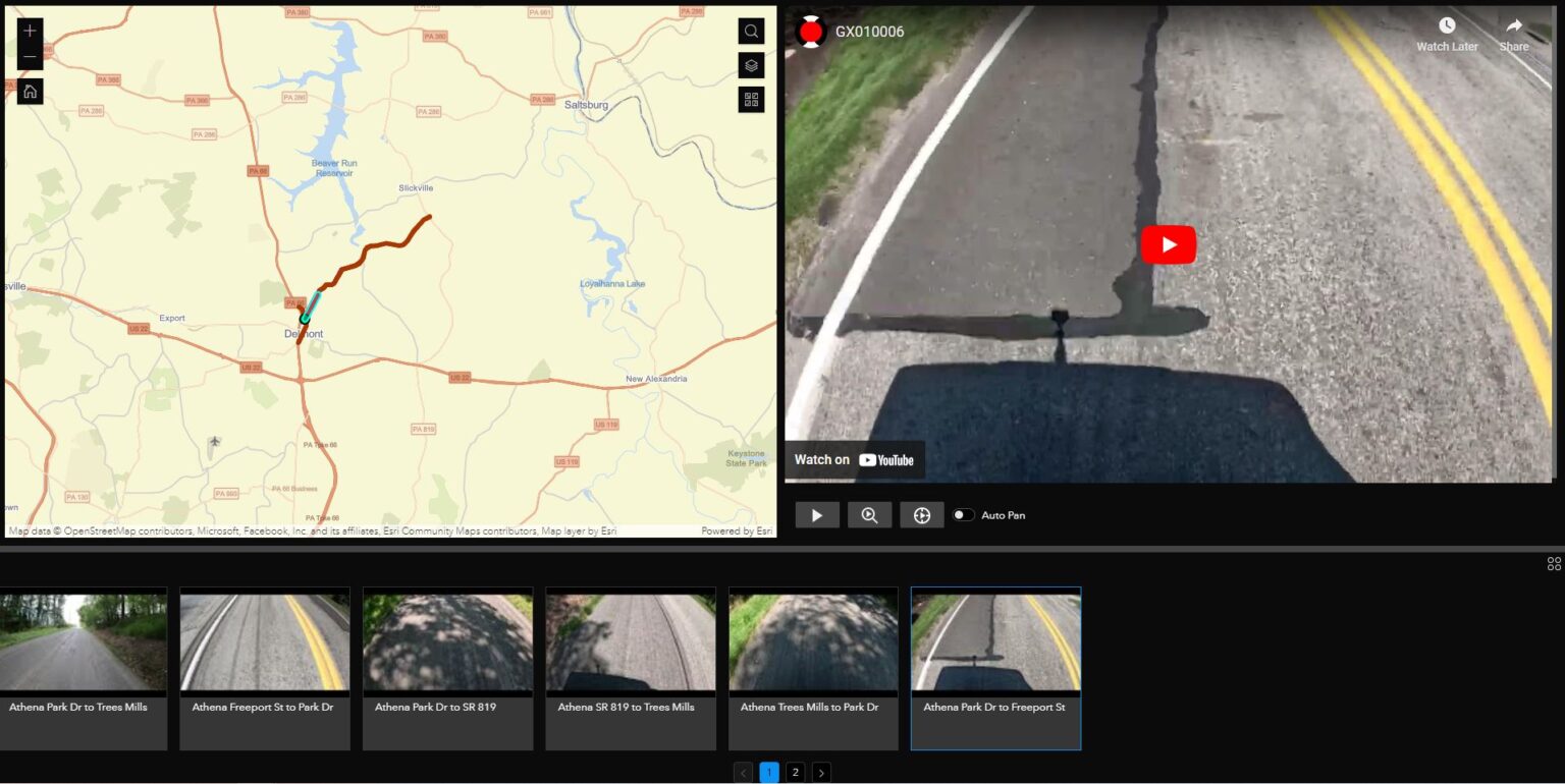
YouTube’s integration with ArcGIS has resulted in a seamless and highly effective solution for road and other infrastructure inspections. Enter “GeoTube for ArcGIS,” a tool that facilitates efficient and cost-effective data collection. By effortlessly incorporating 2D and 360-degree videos into your workflows, GeoTube offers an intuitive understanding of spatial relationships, revolutionizing the inspection experience.
360 and 2D YouTube Videos Geospatially Displayed in ArcGIS:
GeoTube for ArcGIS takes full advantage of geospatial capabilities, presenting video paths and playback locations within web maps. Two-way integration means that you can see the video path and playback location displayed on your map during video playback. The current playback time/location can be controlled via the integrated YouTube player or via clicking any point along the video path in your map. This seamless integration makes it possible to visualize your sites and assets like never before possible.
Simple Video Capture Process:
GeoTube makes video capture a straightforward task for professionals. With the convenience of GPS-enabled cameras, such as smartphones or affordable 360 cameras like the GoPro, project sites can be captured effortlessly. No need to cordon off roads or other projects, as a single driver or field person can drive or walk the site and capture videos from every angle. This reduces liabilities associated with multiple individuals onsite and enhances safety during inspections.
Empowering Non-GIS Personnel:
GeoTube for ArcGIS breaks down barriers for non-GIS personnel, including field staff, surveyors, and civil engineers. With little to no GIS experience, these individuals can now effectively utilize ArcGIS with GeoTube for various applications, boosting collaboration and efficiency.
Use Cases:
- Roadway Management: GeoTube enables quick reporting on roadway conditions, defects, and other transportation infrastructure issues. Whether using ESRI’s Roadway Management solution or a fully customized approach, GeoTube significantly enhances road maintenance efficiency.
- Large Scale 360 Virtual Tours: Immerse clients in geospatially accurate virtual tours of various project sites, from large construction projects to landslides to disaster recovery efforts. Replace traditional presentations with interactive geospatial experiences, enabling seamless communication and greatly improved understanding of project and site conditions.
- Client Collaboration: Project Managers without GIS experience can leverage GeoTube to visualize drainage options, road slopes, nearby landmarks, traffic conditions, and accessibility. This aids in providing accurate quotes and fostering effective client communication.
- AEC Team Efficiency: GeoTube empowers construction teams to visualize construction timelines, conduct site inspections, and manage logistics directly within ArcGIS. 360-degree videos captured by field personnel can be viewed by AEC teams and clients, providing a virtual on-site experience.
Experience Builder for Streamlined Workflows:
Maximize the potential of GeoTube with user-friendly workflows, facilitated by its integration with ArcGIS Experience Builder. Highly configurable solutions enhance efficiency and reduce project costs, backed by Nodeology’s expertise in creating ArcGIS tools for 360 videos and imagery.
Conclusion:
GeoTube for ArcGIS represents a paradigm shift in roadway and other infrastructure inspections. By seamlessly integrating YouTube 2D and 360 videos with GIS data, the tool simplifies data collection, streamlines collaboration, and boosts overall efficiency across disciplines. Explore the potential of GeoTube by visiting us at: http://www.nodeology.net/geotube/.


