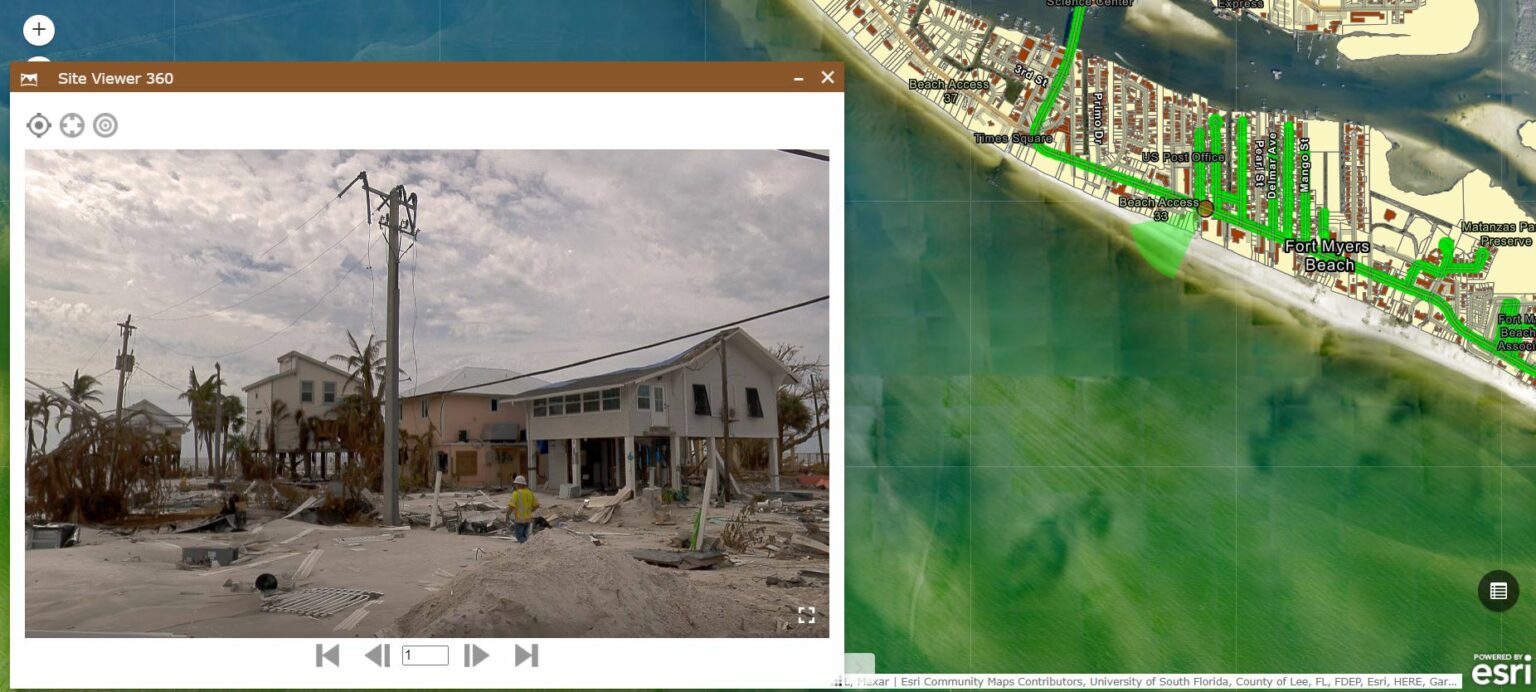
In today’s competitive landscape, the right tool can make all the difference in asset management, infrastructure inspection, and client communication. Enter Site Viewer 360 for ArcGIS, a game-changer that enables seamless integration of 360° imagery within ArcGIS Online and Enterprise. With its immersive visuals, Site Viewer 360 empowers organizations to unlock the full potential of their assets, streamline workflows, and make informed decisions.
To experience the ease of working with 360° imagery in ArcGIS, Nodeology has released three interactive demos available at http://www.nodeology.net/site-viewer-360-for-arcgis/. These demos allow users to immerse themselves in the power of using 360° imagery for engineering projects, gaining firsthand insights into its capabilities with the feeling of being on the ground.
Advantages of Using Site Viewer 360 for Engineering Projects:
- Streamlined Workflows: Save time and enhance efficiency by quickly navigating to specific locations of interest. With Site Viewer 360, engineers and GIS personnel can focus on critical areas without the need to scroll through irrelevant images.
- Immersive Visualization: Gain a comprehensive understanding of jobsites with a 360-degree view. By visualizing assets from all perspectives within ArcGIS, teams can identify crucial details and potential issues more efficiently.
- Progress Monitoring and Remote Inspections: Stay on top of project progress and conduct inspections remotely with real-time insights from updated GIS mapping data. Site Viewer 360 eliminates the need for physical presence on-site, enabling data-driven decision-making.
- Competitive Advantage: Capture imagery cost-effectively using budget-friendly 360° cameras or collaborating with Reality Capture specialists. Accurate and confident project documentation leads to well-supported bids and increased success rates.
- Efficient Collaboration: Foster effective collaboration by sharing realistic on-location experiences with stakeholders. Site Viewer 360 eliminates the need for lengthy descriptions, enabling better understanding and faster decision-making.
- Fully Integrated Solution: Seamlessly integrate Site Viewer 360 within the familiar ArcGIS interface. Display mapped assets alongside 360° imagery for a comprehensive view that enhances accuracy and understanding.
In conclusion, Site Viewer 360 is a powerful tool that empowers organizations to achieve efficient asset management and infrastructure inspection. By leveraging immersive 360° imagery within ArcGIS, teams can enhance workflows, make informed decisions, and stay ahead of the competition. Embrace the power of Site Viewer 360 and unlock new possibilities for your organization’s success.
Discover how Nodeology can optimize your operations with our user-friendly ArcGIS solutions for 360° video and imagery. Visit our website at www.nodeology.net or reach out to us via email at info@nodeology.net. We are committed to supporting your organization’s success.
About Nodeology:
Nodeology specializes in developing user-friendly ArcGIS tools for 360° video and imagery, with a particular focus on streamlining road and infrastructure inspections. Our solutions are tailored to enhance workflow efficiencies, reduce project costs, and mitigate on-site liabilities. With Nodeology, you can achieve optimal results in your operations, benefiting from improved efficiency and enhanced data visualization capabilities.


