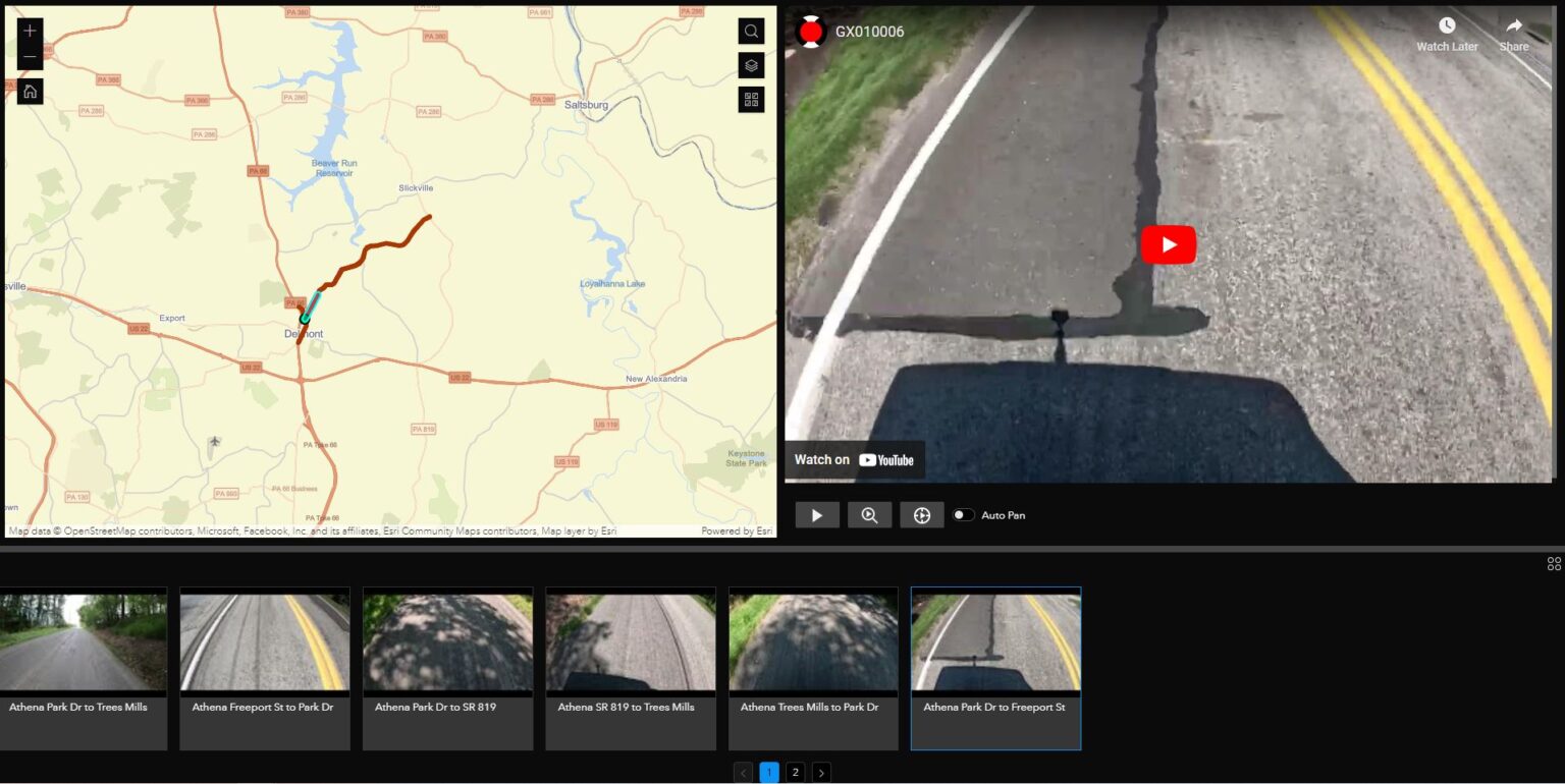
Join Anthony Grescavage from Nodeology on a 360° visual journey within ArcGIS, where road and infrastructure inspections attain unmatched workflow efficiencies.
𝐑𝐨𝐚𝐝𝐰𝐚𝐲 𝐌𝐚𝐧𝐚𝐠𝐞𝐦𝐞𝐧𝐭:
For professionals in the Oil & Gas industry, road damage can lead to significant DOT liabilities. Discover how real-time monitoring empowers you to visualize before-and-after conditions, collaborate seamlessly with transportation agencies, and mitigate potential liabilities.
𝐆𝐞𝐨𝐬𝐩𝐚𝐭𝐢𝐚𝐥 𝐕𝐢𝐝𝐞𝐨 𝐢𝐧 𝐀𝐫𝐜𝐆𝐈𝐒:
Experience the power of video integration in ArcGIS, where you can swiftly report on road conditions, defects, and transportation infrastructure. Whether you’re utilizing ESRI’s Roadway Management solution or a customized approach, geospatially accurate video turbocharges your roadway management efficiency.
𝐂𝐨𝐧𝐬𝐮𝐦𝐞𝐫-𝐆𝐫𝐚𝐝𝐞 𝟑𝟔𝟎° 𝐂𝐚𝐦𝐞𝐫𝐚𝐬:
Witness live demos with affordable 360° cameras. These compact cameras provide panoramic, detailed insights without the complexities, high costs, or logistical challenges associated with UAVs or lidar systems.
𝐄𝐦𝐩𝐨𝐰𝐞𝐫𝐢𝐧𝐠 𝐍𝐨𝐧-𝐆𝐈𝐒 𝐏𝐫𝐨𝐟𝐞𝐬𝐬𝐢𝐨𝐧𝐚𝐥𝐬:
What truly sets this innovation apart is its ability to empower individuals, regardless of their GIS experience. We’ve designed workflows that are straightforward and visualization-centric, ensuring that all departments can unlock their full potential. This democratization of geospatial softwares enhances project delivery, cuts costs, and elevates service to our communities.
𝟑𝟔𝟎° 𝐕𝐢𝐝𝐞𝐨 𝐒𝐨𝐟𝐭𝐰𝐚𝐫𝐞 𝐟𝐨𝐫 𝐀𝐫𝐜𝐆𝐈𝐒:
Dive deep with GeoTube for ArcGIS. This user-friendly software simplifies 360° video integration in ArcGIS and caters to professionals at all GIS experience levels.
Join us at EnerGIS 2023 and be at the forefront of the geospatial revolution! We can’t wait to see you there.


