Geotagged Videos to Polylines
Description
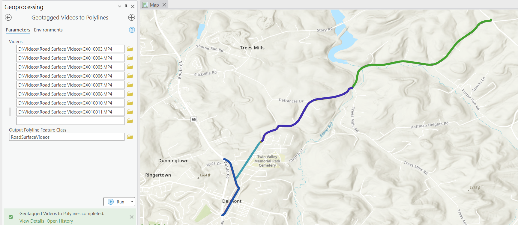
The Geotagged Videos to Polylines tool creates polyline features from geotagged video files. By using the GPS information recorded in the videos, it creates accurate polyline representations suitable for various GIS applications. The tool is designed to be fully compatible with Nodeology’s geo-immersive video widgets, while also providing utility for a wide range of other geospatial tasks.
Key Features:
- Supports a wide range of video formats.
- Transforms video travel paths into precise polyline features.
- Natively compatible with Nodeology’s video widgets.
Geotagged Video to Photos
Description
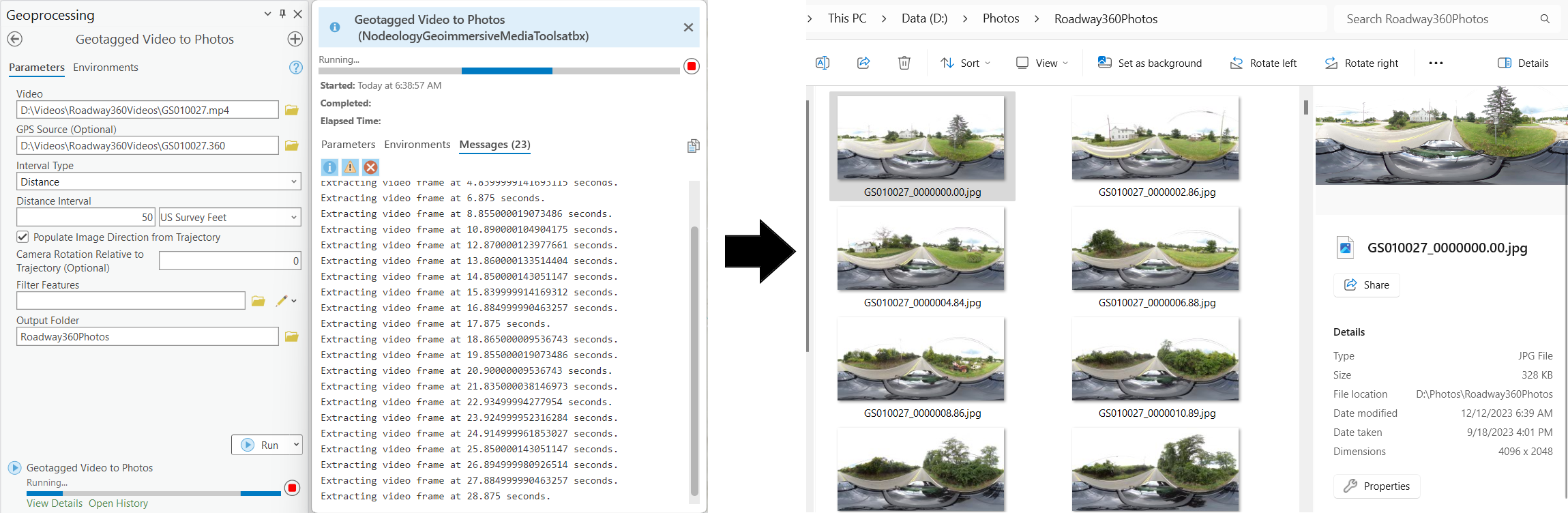
The Geotagged Video to Photos tool is an innovative solution for converting geotagged videos into georeferenced photos at user-defined intervals.
This tool is versatile, supporting both standard and 360° panoramic videos, and preserves the format of the source video in the extracted images. Whether your source is a conventional 2D video or a panoramic 360° video, the output will match, ensuring seamless integration into your existing geospatial workflow.
Key Features
- Extract photos at specific time or distance intervals.
- Optionally extract photos within a certain distance of specified locations.
- Optionally populate image direction tags from video trajectory.
- Maintains the original format of the source video, whether it’s standard or 360° panoramic.
- Simplifies and streamlines video and photo collection workflows.
- No need to worry about photo capture intervals during data collection.
- Exported photos can be easily added to your map using Geotagged Photos to Points or Append Geotagged Photos to Points geoprocessing tools.
Calculate Trajectories Between Points
Description
The Calculate Trajectories Between Points tool populates a numeric field with the trajectories between points in a point feature class. This provides a calculated/estimated direction for use in cases where directional information is not available, such as when using a 360° camera without an onboard magnetometer/compass.
Key Features
- Populate direction field in a point feature class.
- Specify “Order By” field.
- Optionally specify output tolerance warnings table to warn of cases where the calculated trajectory may differ significantly from the actual trajectory. Useful for manual review and editing.